Introduction:
North American Grasslands
| Terrain within the prairies is generally level to rolling. The
glaciated northeastern sector is generally more level than the
unglaciated western part. Extensive glacial till plains and glacial
lake beds are almost dead flat. Broken topography in the tallgrass
prairie is generally forested. Extensive badlands (very broken,
eroded topography) occur in parts of the western grasslands. Trees,
especially junipers and ponderosa pine, occur in some of the areas
of more broken topography. They are common in the North Dakota
badlands, and on bedrock, especially sandstone, escarpments
throughout the Great Plains. Extensive dunes occur throughout the
western prairies, most notably the Nebraska Sandhills which cover
much of the State, but smaller dune fields are widespread. The
dunes fields are mostly stabilized by grassland today, but many
have been active in the recent past.
|
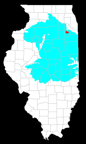 The Grand Prairie in Illinois Midewin NTP in Red |
A strong east to west decrease in precipitation exists across the North American grasslands, with most of the grassland region having a moisture deficit in which evaporation exceeds precipitation. The Prairie Peninsula, however, is distinctive in having a moisture surplus on average, with precipitation exceeding evaporation. Thus, a puzzle to many observers has been why this wedge-shaped extension of prairie even exists.
The grasslands experience a "monsoonal" climate characterized by low winter precipitation and high summertime precipitation. Dry western and arctic air masses predominate in the west, but to the east, the westerly air stream is pinched between two air masses containing more moisture. The Alberta storm track, to the north, is responsible for heavier snowfall in Minnesota and northeastern Iowa. To the southeast, moist, tropical air from the Gulf of Mexico brings abundant precipitation. During summer, continental heating causes air to rise and creates low pressure in the mid-continent, drawing in moist air from the Gulf. Areas nearer to the Gulf, including the Prairie Peninsula, receive proportionately more precipitation.
During non-drought years in the eastern grasslands, summer precipitation is as great as in adjacent forested areas. During drought years, however, the Prairie Peninsula suffers more extreme drought because a wedge of dry, westerly air penetrates farther east than usual, blocking moist air from the Gulf (Borchert, 1950, Wright, 1968). The greater severity of drought in the Prairie Peninsula is one of the important factors favoring the persistence of prairie in a climatic regime otherwise favorable for forest.
Next | Back