Precipitation Maps of the Prairie
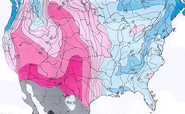 |
| Precipitation minus evaporation in centimeters
(Winter, 1989). |
Winter's map (above) shows overall precipitation to be equal
between the Prairie Peninsula and deciduous forests to the east.
However during drought years, (Borchert's map, below) a wedge of
dry, westerly air penetrates farther east than usual and blocks the
moist Gulf air. The greater severity of drought in the Prairie
Peninsula is one of the important factors favoring the persistence
of prairie in a climatic regime otherwise ammenable to forests.
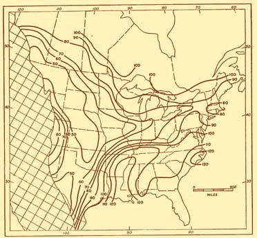 |
| Percent of normal rainfall in average July of
major drought years (Borchert, 1950). |
https://exhibits.museum.state.il.us/exhibits/midewin/borchertmap.html, Last modified September 1st 2011, 08:13PM.