Illinois State Museum
Click on active spots for more information.
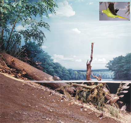
Illinois River, Fulton County, 1673
The Illinois River begins at the junction of the Des Plaines and Kankakee rivers in northeastern Illinois. It flows to the southwest for 439 kilometers (273 mi.) then joins the Mississippi River. It drains an area of 73,000 square kilometers (28,000 sq. mi.) in Illinois, southeastern Wisconsin, and northern Indiana.
This reconstruction shows the river at Liverpool, Illinois, near the river's midpoint. It is based on historic records and archaeological, biological, and geological evidence. This cross-section shows that, within a small area, there are three different habitats—river channel, natural levee, and backwater lake. Each has different living conditions and is home to different plants and animals.
River Channel
In 1673, parts of the Illinois River were shallow, slow-moving, and choked
with acqatic plants. The river supported large populations of fish, waterfowl,
turtles, and freshwater mussels. Native Americans harvested the rich resources
of the river for thousands of years. In the seventeenth century, the
French established forts along the river to pursue the fur trade with
the Illinois Indians. See People and the Illinois River.
The river section in this reconstruction is shallow with a bed of sand and gravel. The plants and animals in the channel are adapted to life in flowing water. Freshwater mussels live on the bottom.